Montreal, Quebec — Beauce Gold Fields (Champs D’Or en Beauce) (TSXV: ¨BGF¨), (“BGF”): (“BGF” or the “Company”), referred to as “BGF” or the “Company,” is pleased to announce it has commenced a geophysics, mapping and sampling program in preparation for follow-up drilling of the Grondin antifom structure on the Company’s Beauce Gold property, located in the Beauce region of southern Quebec.
Patrick Levasseur, President and CEO of Beauce Gold Fields, states, “Starting this geophysics, mapping, and sampling program marks a significant step forward in our exploration efforts at the Grondin antiform structure. Our exploration data indicates that the origins of the historical placer gold deposit are mineralized antiform structures such as the Grondin antiform.
This will not only guide our upcoming drilling targets but also enhance our ability to unlock the full potential of the Beauce Gold property.”
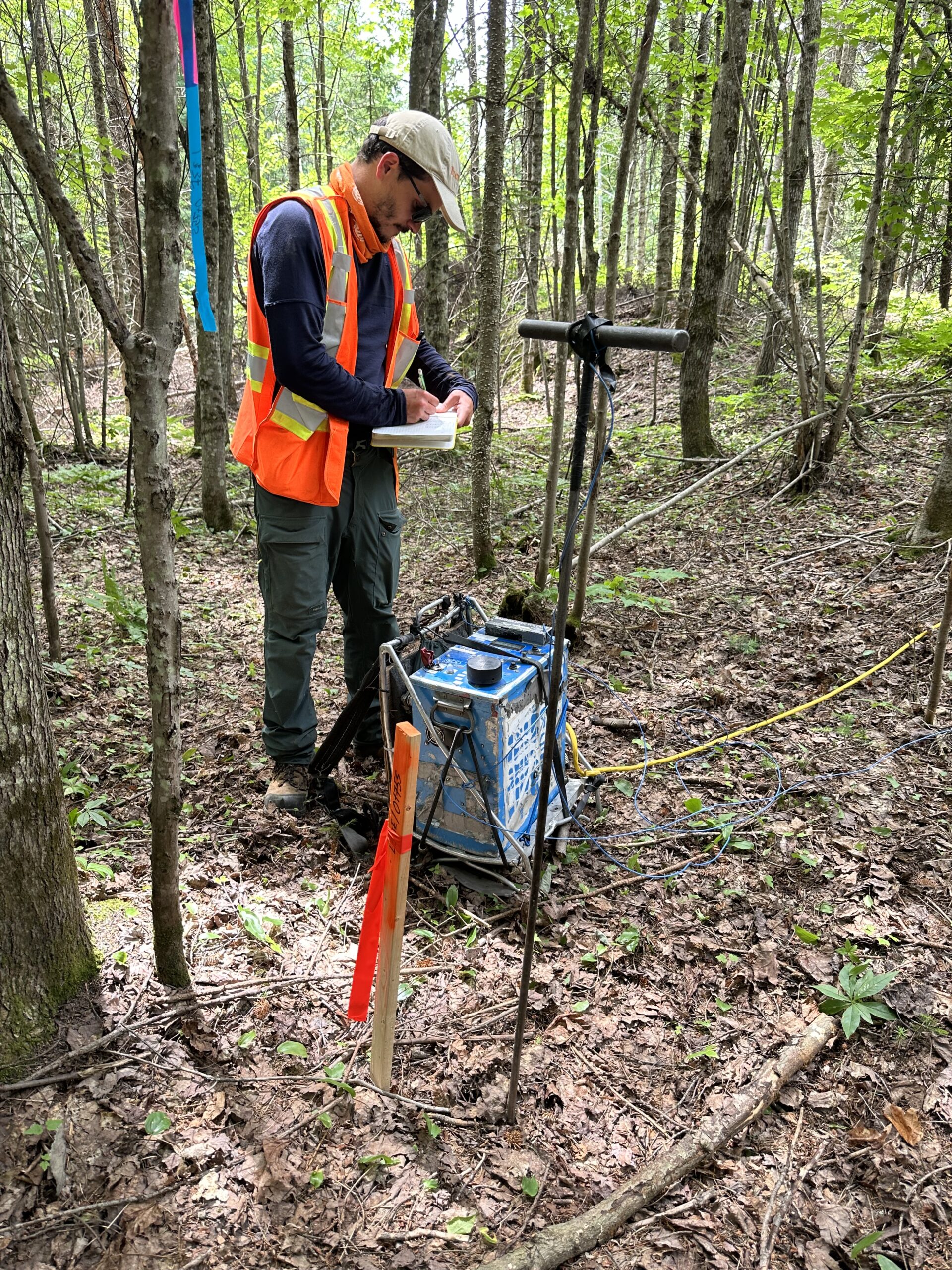
Image: Geophysics technician surveying the Grondin Zone
The Company has commenced phase one of an Induced Polarization (IP) geophysics survey to identify the Grondin antiform structure along its southwest to northeast strike over a distance of 8km. This survey was conducted by completing a grid of eight 1km lines, spaced approximately 1km apart. The Grondin gold mineralized outcrop and antiform structure (Saddle Reef) were identified through drilling in 2023 (refer to BGF press releases dated 2023-11-01, 2024-01-18, and 2024-03-20). Additionally, the Company completed a field mapping survey to identify features from historical geological studies. The IP grid was laid out based on the information from this field mapping survey, corresponding to an antiform axis first mapped by geologist Pierre Cousineau in 1988 (Report MM 87-02).
IP sections showing anomalies will be followed by geochemical soil sampling. The Company’s previous soil results correlated well with the lithology of the Grondin Zone mineralized structure (refer to BGF press release 2024-04-25). Geochemical soil sampling results have identified a suite of anomalous elements corresponding with the mineralized gold zones of the Grondin antiform outcrop.
Phase two, planned for August, involves a tighter grid of 10 lines, each 100 meters apart, covering the Grondin Zone. This will facilitate the creation of a 3D model to determine the dip and direction of mineralized stockworks in the felsic lapilli tuff within the antiform structure.
The combined IP data, geochemical results, and structural data will guide the selection of drill hole targets for a follow-up drill program. This information will enable the Company to file the compulsory “Autorisation pour travaux à impact” (ATI) with the Quebec Ministry of Natural Resources for drilling authorization.
Jean Bernard, B,Sc. Geo., is a qualified person, as defined by NI 43-101, who has reviewed and approved the technical information presented in this release.

Beauce Gold Fields is a gold exploration company focused on placer to hard rock exploration in the Beauce region of Southern Quebec.