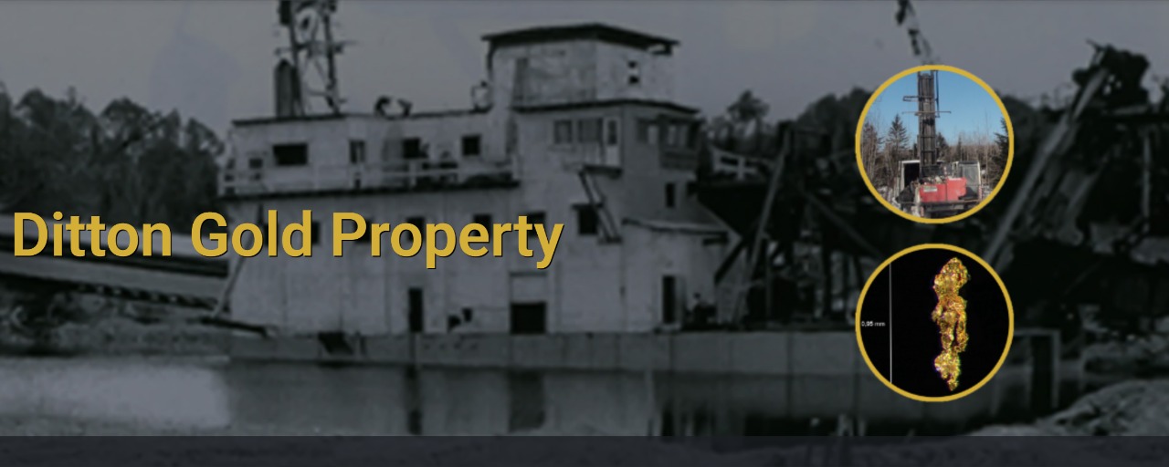
Ditton Gold Property
Located in Chartierville, Quebec, near the U.S.–New Hampshire border, the Ditton Property encompasses a newly discovered paleoplacer gold channel. This area hosts extensive placer gold anomalies and exhibits strong geochemical and structural indicators, supporting exploration for lode gold and the potential identification of the primary source of the placer deposits.
Location
The property is situated in southern Quebec within the municipality of Chartierville, approximately 5 km north of the U.S.–New Hampshire border.
History
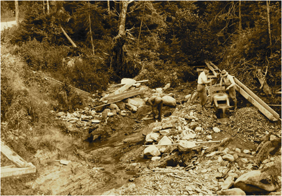
Placer gold was first discovered in the late 1800s by Archie Annance, a prospector from the Abenaki First Nation. His discoveries led to alluvial gold mining in various streams and small rivers, including Mining Brook, located about 5 kilometers north of Chartierville. Historical records indicate that over 25,000 ounces of gold were extracted from a small section of Mining Brook.
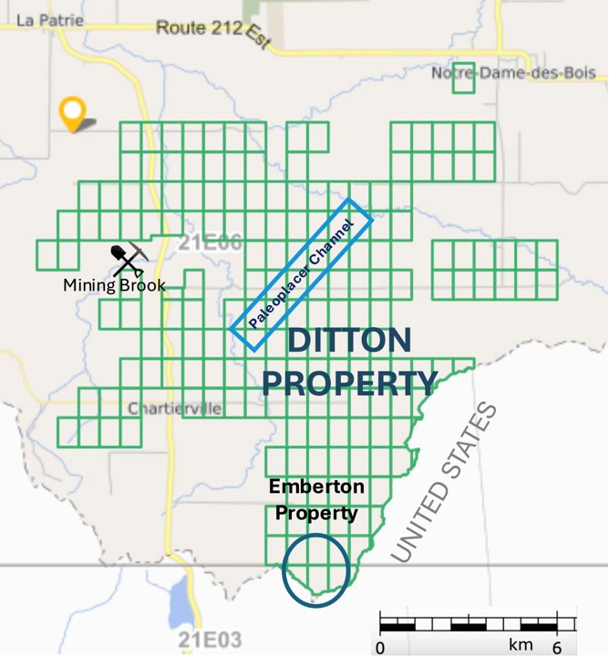
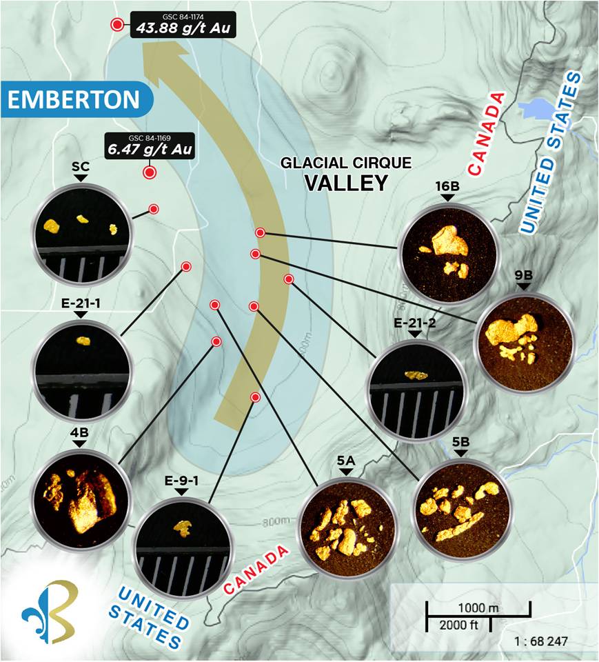
The Ditton Placer Gold Channel
Beauce Gold Fields discovered a significant paleoplacer gold channel, which has since been the focus of extensive exploration. This discovery was the result of a systematic exploration approach that combined historical research with modern technologies, including geophysics, sonic drilling, and bulk sampling.

Geophysical Surveys and Drilling
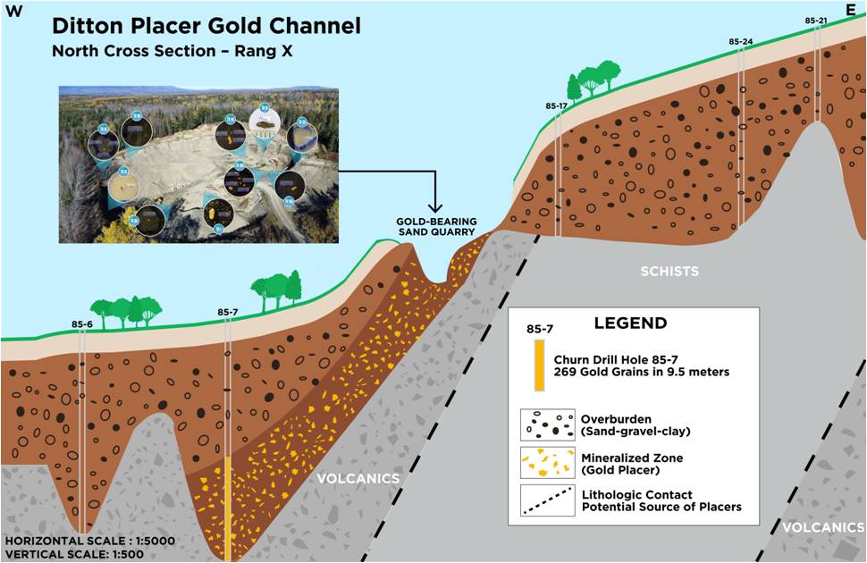
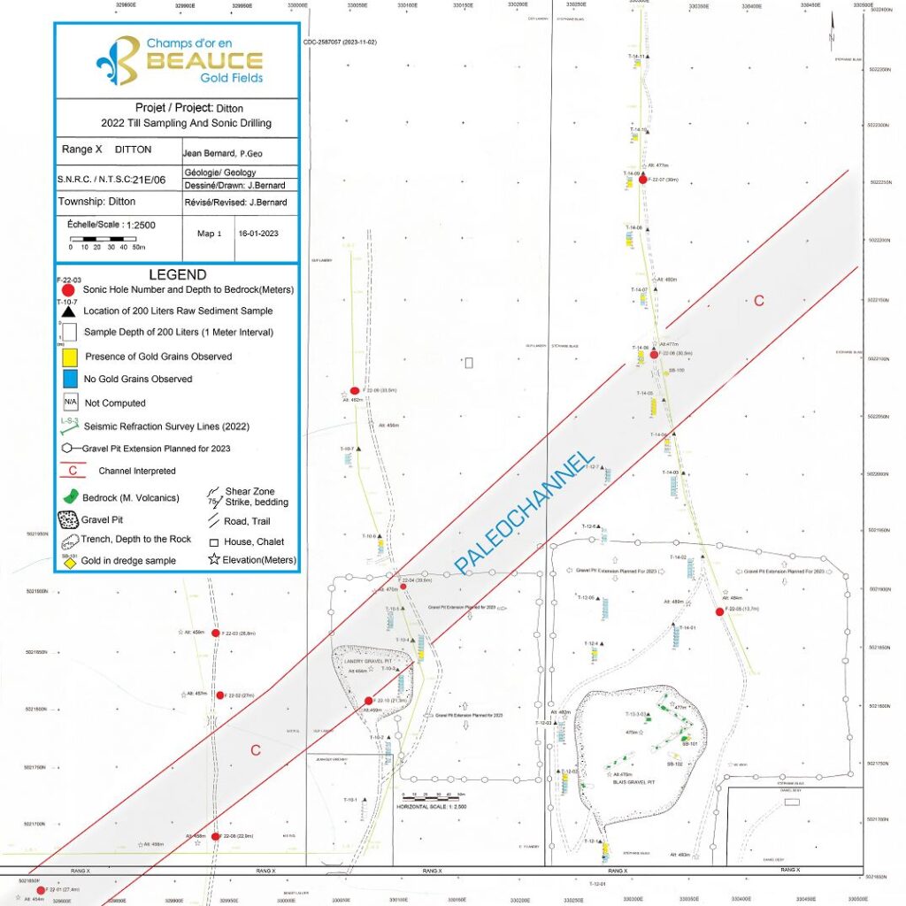
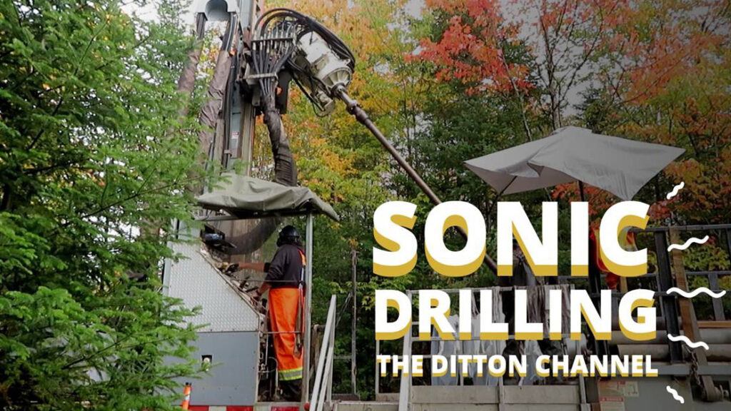
To determine the extent and depth of the paleoplacer channel, Beauce Gold Fields conducted seismic refraction surveys followed by overburden sonic drilling. These efforts confirmed the presence of a gold-bearing paleochannel.
In June 2023, the company reported that all four sonic drill holes intersected gold-bearing gravels. Notably, Hole F-22-10, drilled in the Landry Quarry, yielded 3.36 grams per cubic meter (g / m3) of tertiary placer gold at a depth of 15 meters.
Bulk Sampling and Gold Concentrate Analysis
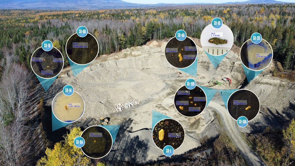
Further exploration included bulk sampling to evaluate the gold content of the channel. In August 2023, a 50-ton sample from the SB-100 site produced a concentrate averaging 154.98 grams of gold per ton, including a notable 5mm gold nugget. Significant quantities of pyrite were also observed, suggesting a complex mineral association.
Potential for Lode Gold Discoveries
Gold particles recovered from the Ditton sand quarry showed delicate angular shapes, indicating minimal transport and suggesting a nearby bedrock source. This source may originate from orogenic gold-type mineralized zones, possibly eroded from the eastern flank of the valley wall. The bedrock lithology at this site features a contact between altered volcanic rock and schist. Historical surveys have also identified strong magnetic lineaments in the area, which are favorable for hosting gold-bearing quartz lenses.
The Bella Fault line is estimated to run approximately 1 km east of the placer channel. In 1985, Cache Exploration drilled three diamond drill holes (DDH) along Rang Dix Road to test a strong shear zone. These holes intersected andesitic rocks with numerous quartz stringers mineralized with pyrite and significant tourmaline. Of particular interest, DDH S-2 recorded visible gold at a depth of 240 meters (GM42843). However, Cache did not proceed with the recommended follow-up drilling to further investigate this anomaly.
Let me know if you’d like a shorter version, a version adapted for investors, or something translated into French.
About Our Company
Beauce Gold Fields is a gold exploration company focused on placer to hard rock exploration in the Beauce region of Southern Quebec.