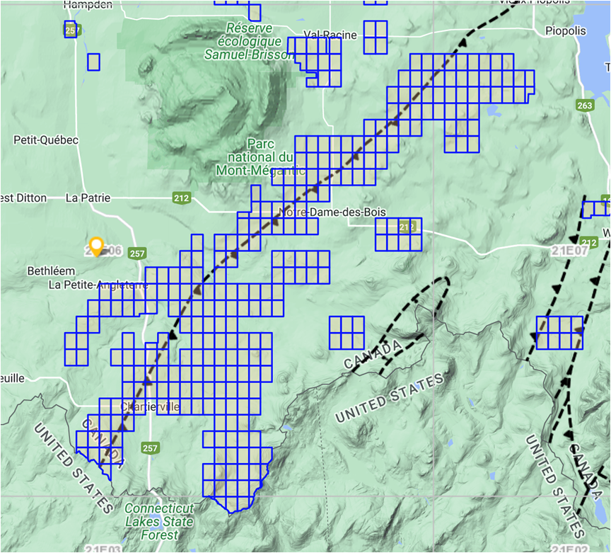
The Ditton property is located in southern Quebec in the municipalty of Chartierville. Quebec
The property is comprises of 310 claims that extends for at least 15 km along the axis of the Bella Fault. It is divided into four areas historic placer gold districts: the Ditton, the Mining Brook, the Chesham and the Emberton.
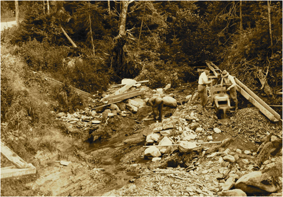
Placer gold was first discovered in the late 1800s by Archie Annance, a prospector from the First Nations community of Odanak,Quebec. Hi discoveries lead to occurrences of alluvial gold mining in some streams and small rivers, including the Mining Brook located some five km north of Chartierville. It has been reported in the that over 25,000 ounces of gold was mined from just a small stretch of Mining Brook.
The Bella fault line, which is the major structural element of theDittonproperty, is in contact between the Compton and Frontenac Formations of the Appalachians. Observations suggest several intrusive phases that would be favorable to the establishment of gold mineralization.
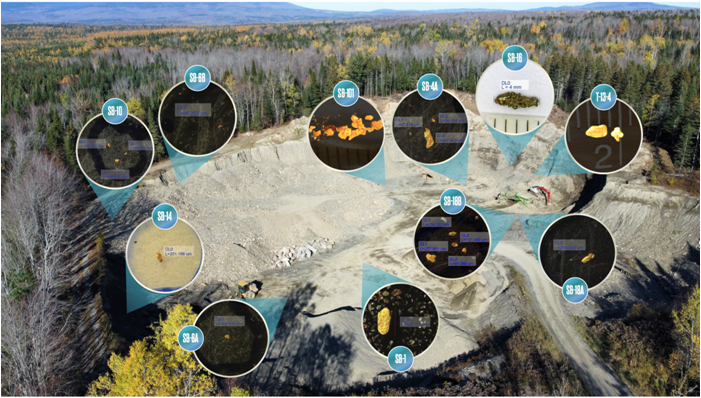
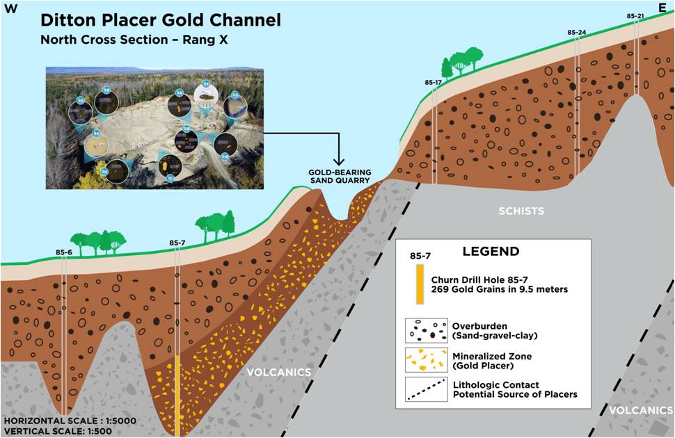
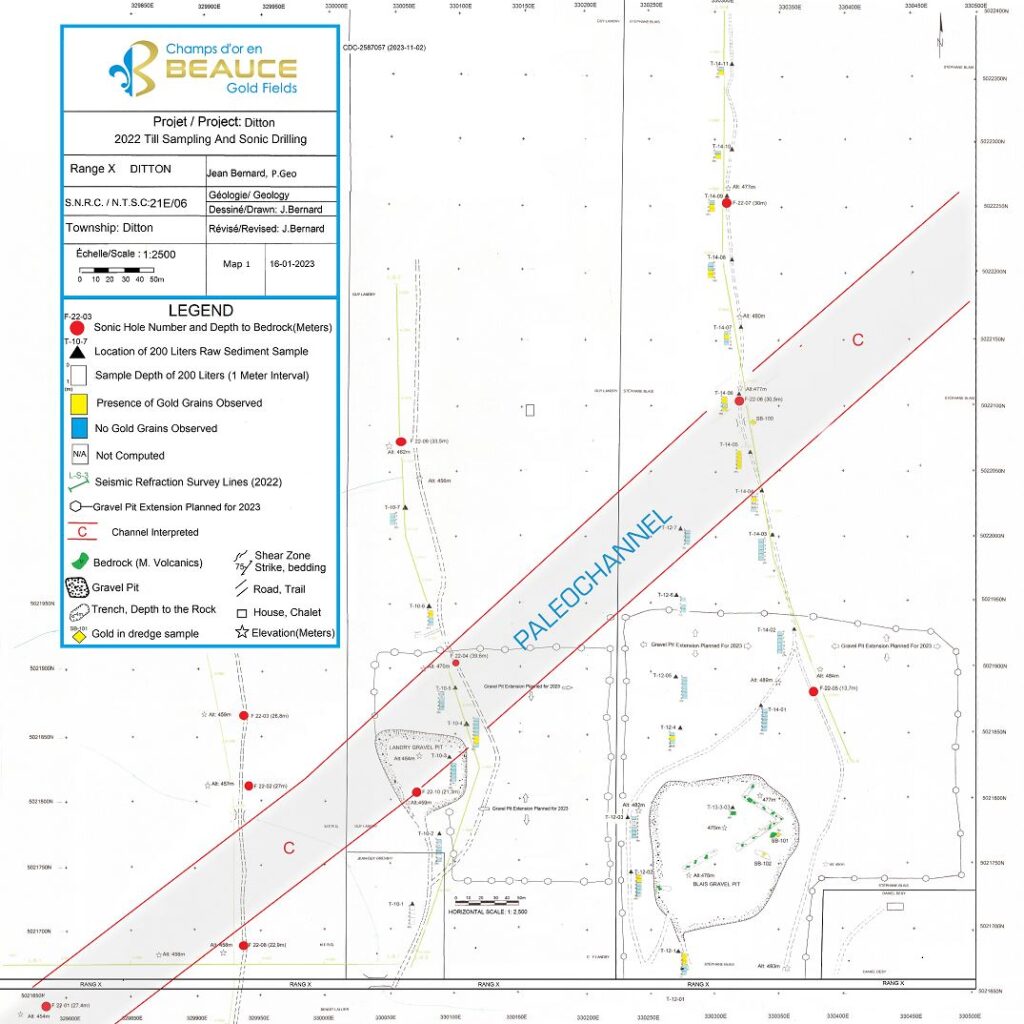
The Ditton Placer Gold Channel
Beaauce Gold Fields discovered a placer channel 4 km east of the historical Mining Brook placer gold mine and 6 km northwest of the US New Hampshire border.
The discovery of the Ditton Placer gold channel was the result of a systematic approach to exploration, combining historical research with modern techniques and technology that included geophysics, sonic drilling and bulk sampling.

Potential for Lode Gold Discoveries
The gold particles from the Ditton sand quarry showed delicate angular shapes suggesting little transportation. A proximal bedrock source of the placer channel could be from the eroded Eastern flank of the valley wall. The bedrock lithology holds a contact point between altered volcanic rock and schist rock. Historical surveys indicated strong magnetic lineaments favourable to hosting gold-bearing quartz lenses.
The Bella Fault line is estimated to run along strike 1 km east of the placer channel where Cache Exploration in 1985 put down 3 diamond drill holes (DDH) along Rang Dix road to test a strong shear zone. The holes intersected andesites containing numerous quartz stringers mineralized with pyrite and much tourmaline. Of interest, in the drill log for DDH number S-2 states that visible gold was noted at 240 meters (GM42843). Cache did not complete the recommended follow-up drilling to test this anomaly.
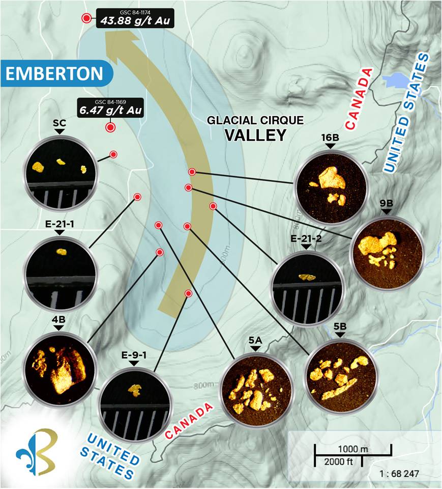
Emberton
The Company identified a 4 km long placer gold dispersal trail originating out of a glacial cirque mountain valley formation on the Canadian side of the Quebec/New Hampshire boarder.
The Emberton could be a southern extension of the Ditton Placer Channel.
About Our Company
Beauce Gold Fields is a gold exploration company focused on placer to hard rock exploration in the Beauce region of Southern Quebec.