Montreal, Quebec — Beauce Gold Fields (Champs D’Or en Beauce) (TSXV: ¨BGF¨), (“BGF”): (“BGF” or the “Company”): referred to as “BGF” or the “Company,” is pleased to announce the successful completion of a diamond drilling campaign consisting of 9 drill holes, totaling 500 meters, along the axis of an antiform outcrop at the Grondin showing on the Beauce Gold property. This property is situated in St-Simon les Mine and Beauceville, Quebec.
Patrick Levasseur, President and CEO of Beauce Gold Fields, stated, “The drilling campaign along the Axis of an Antiform outcrop at the Grondin showing is designed to test for the presence of a Saddle Reef Formation, which is a leading geological model for potential lode gold discoveries and could potentially be the source of the historical placer gold deposit.”
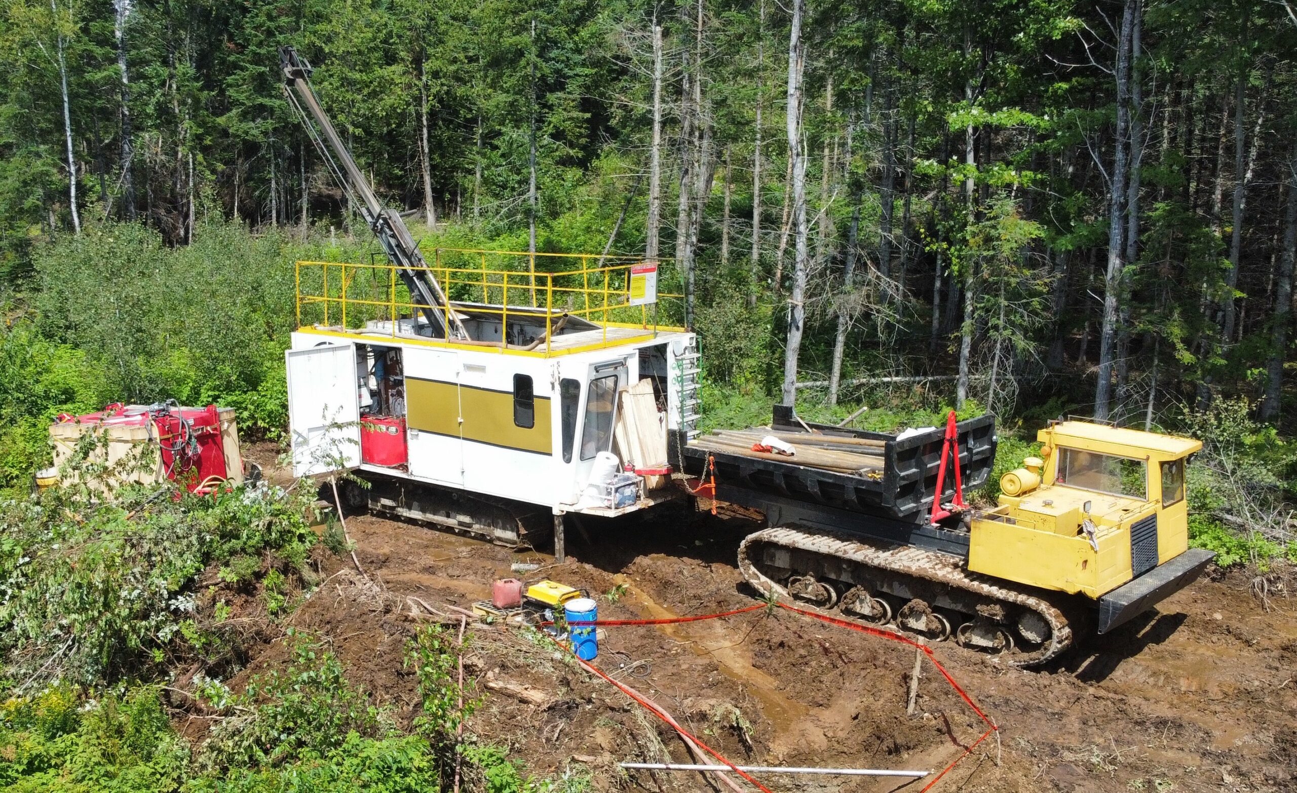
Image 1: Diamond drill rig on the Beauce Gold property
The drilling effort was carried out at two locations, spaced 300 meters apart, along exposed sections of the Grondin outcrop. Each location involved the drilling of a series of HQ diameter holes at increasing intervals into the northeast-dipping flank of the mineralized structure. Two holes were drilled in the same section with an additional hole in the opposite direction to verify the real thickness of the mineralization zones and to confirm the dipping of the host rock. Splitting and logging of diamond drill hole cores will be completed at the Company’s Saint-Simon-les-Mines core shack. Selected core samples will be sent to be analyzed for gold content at MSA Lab in Val D’Or, Quebec.
About the Grondin outcrop
The Grondin outcrop reveals a substantial mineralized quartz vein stockwork of the Crack and Seal type, visible along the Axis of the Antiform. This axis outcrop extends 500 meters northeast along strike on the northwest portion of the Beauce Gold property. Notably, it lies approximately 3 kilometers upstream from the 19th-century placer gold mines at Giroux Creek and Gilbert River confluence, paralleling the historical placer gold deposit of St-Simon-les-Mine. Among the samples collected, two showed particularly high gold grades: sample 81755 at 2.11 grams/ton and sample 81763 at 10.9 grams/ton (GM 70761 Réjean Hébert, geologist, June 2018). The Company also conducted grab samples, with results ranging from 200 ppb Au to 1,400 ppb Au.
Axis of Antiforms and a Saddle Reef formation
A primary objective of the recent drilling campaign was to verify the hypothesis of a Saddle Reef Formation as the predominant geological model for potential lode gold discoveries and a possible source of the historical paleoplacer gold deposit.
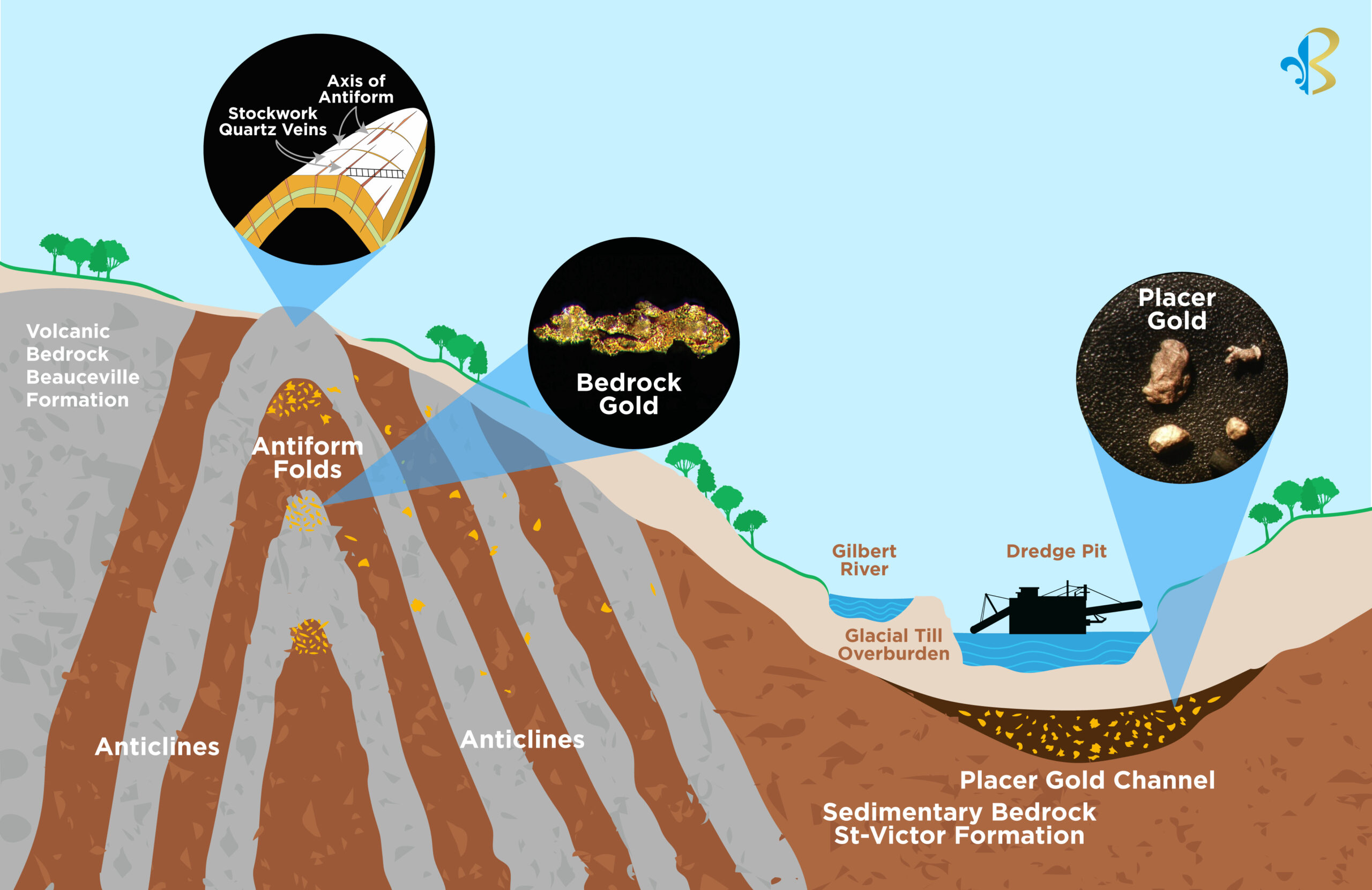
Image 2: Conceptual Model of a Saddle Reef Formation
This conceptual geological model finds support in IP surveys, observations of eroded anticline vertical limbs in layered sedimentary and volcanic bedrock from 2019-2020 trenches, and the discovery of exposed domed Axis of Antiform ridges along Giroux Creek. This axis trends northeast to southwest for 4 kilometers north of the Gilbert River, aligning with the historical placer gold channel (BGF press releases 2021-12-21, 2021-03-19). Eroded sections of the Saddle Reef formation are considered a leading hypothesis for the source of the historical placer gold deposit.
The hypothesis suggests that the placer gold within the Beauce Gold paleochannel, including the renowned large nuggets from the 19th century, were formed in stressed quartz pockets within layered domed Axis of Antiforms, as demonstrated by Saddle Reef formations. Notable global examples of Saddle Reef formations include the Bendigo and Ballarat gold fields in Australia (over 60 million ounces) and the high-grade Dufferin deposit in Nova Scotia.
The weathering of sulphides and substantial erosion of quartz veins and antiform folds in the conceptual bedrock Saddle Reef formation northeast of the paleoplacer channel may have released gold and material that contributed to the formation of a thick colluvial mantle over the sides and bottom of the Gilbert River valley. Coarse gold grains and nuggets are believed to be both detrital and chemically derived. The former results from weathered rock, while the latter necessitates the gold first going into solution before precipitating as growing nuggets in fractured saprolite and oxidized shale layers.
Furthermore, the Company executed a 30-ton bulk sample extraction from the Grondin outcrop. A mobile placer plant equipped with a trommel and sluice will be deployed on-site to process the heavily fractured quartz stockwork. Larger fragments will be crushed separately. This process enables the concentration of heavy minerals, including gold, from the collected materials. The concentrates resulting from the bulk sampling will be analyzed for gold content at MSA Lab in Val D’Or, Quebec.
Jean Bernard, B.Sc. Geo., a qualified person as defined by NI 43-101, has reviewed and approved the technical information presented in this release.

Beauce Gold Fields is a gold exploration company focused on placer to hard rock exploration in the Beauce region of Southern Quebec.